
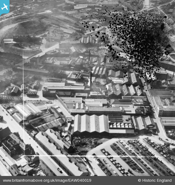
EAW040019 ENGLAND (1951). The Novo Steel Works and the surrounding industrial area, Attercliffe, 1951. This image has been produced from a damaged negative.
© Copyright OpenStreetMap contributors and licensed by the OpenStreetMap Foundation. 2026. Cartography is licensed as CC BY-SA.
Nearby Images (17)
EAW040019

EAW040018

EAW040020

EAW040024

EAW040023

EAW040025

EAW040022

EAW040021

EPW005955

EPW005953

EPW005956

EPW005950

EPW005954

EPW005951

EPW005952

EAW020079

EAW009656

Details
| Title | [EAW040019] The Novo Steel Works and the surrounding industrial area, Attercliffe, 1951. This image has been produced from a damaged negative. |
| Reference | EAW040019 |
| Date | 17-September-1951 |
| Link | |
| Place name | ATTERCLIFFE |
| Parish | |
| District | |
| Country | ENGLAND |
| Easting / Northing | 437273, 388561 |
| Longitude / Latitude | -1.4394512703038, 53.392304815737 |
| National Grid Reference | SK373886 |
Pins

Cyberbia |
Sunday 15th of September 2019 10:55:12 PM | |
|
Cyberbia |
Sunday 15th of September 2019 10:54:25 PM | |

Class31 |
Monday 27th of July 2015 11:03:38 AM | |
|
Class31 |
Monday 27th of July 2015 11:02:54 AM | |
|
Class31 |
Monday 27th of July 2015 11:02:08 AM |