
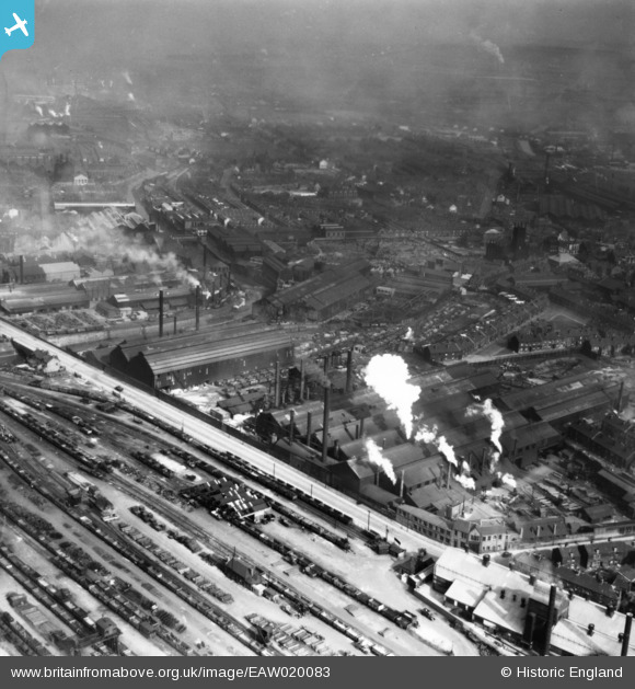
EAW020083 ENGLAND (1948). The English Steel Corporation Stevenson Road Works and adjacent goods yard, Attercliffe, 1948. This image has been produced from a print.
© Copyright OpenStreetMap contributors and licensed by the OpenStreetMap Foundation. 2026. Cartography is licensed as CC BY-SA.
Nearby Images (16)
EAW020083

EAW020081

EAW018791

EAW020080

EAW020084

EAW020085

EAW020087

EAW018789

EAW018792

EAW018787

EAW018788

EAW020082

EAW020086

EAW018790

EAW020078

EAW020079

Details
| Title | [EAW020083] The English Steel Corporation Stevenson Road Works and adjacent goods yard, Attercliffe, 1948. This image has been produced from a print. |
| Reference | EAW020083 |
| Date | 19-October-1948 |
| Link | |
| Place name | ATTERCLIFFE |
| Parish | |
| District | |
| Country | ENGLAND |
| Easting / Northing | 437670, 388923 |
| Longitude / Latitude | -1.4334378907278, 53.395530722497 |
| National Grid Reference | SK377889 |
Pins

Matt Aldred edob.mattaldred.com |
Monday 30th of November 2020 08:23:13 PM | |

Chris Kolonko |
Tuesday 12th of September 2017 09:09:36 PM | |
|
travellingpass |
Friday 19th of December 2014 12:23:35 PM | |
|
John Wass |
Saturday 6th of September 2014 05:20:20 PM |