
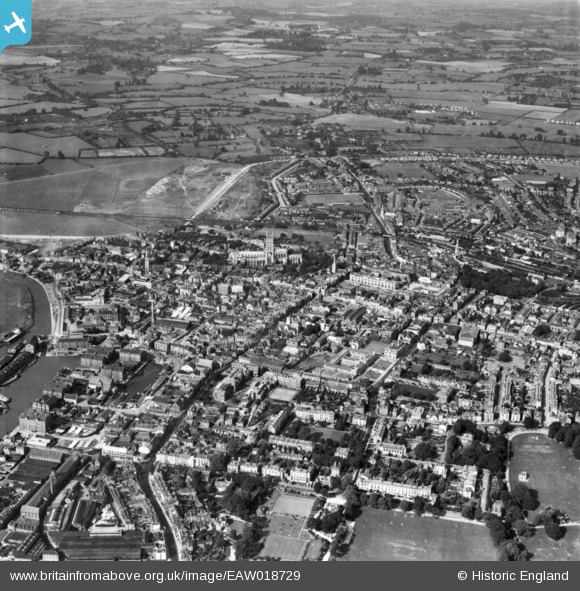
EAW018729 ENGLAND (1948). The city, Gloucester, 1948. This image has been produced from a print.
© Copyright OpenStreetMap contributors and licensed by the OpenStreetMap Foundation. 2026. Cartography is licensed as CC BY-SA.
Nearby Images (30)
EAW018729

EAW000727

EPW024165

EAW003566

EPW024169

EAW003565

EAW000730

EPW024152

EPW024155

EPW024163

EPW006011

EPW024158

EAW003569

EAW003568

EAW003567

EPW041487

EAW000726

EAW032306

EAW032304

EAW032305

EPW037835

EPW024170

EAW000728

EAW032303

EPW024106

EAW000731

EPW006016

EAW012147

EAW000729

EPW037845

Details
| Title | [EAW018729] The city, Gloucester, 1948. This image has been produced from a print. |
| Reference | EAW018729 |
| Date | 31-August-1948 |
| Link | |
| Place name | GLOUCESTER |
| Parish | |
| District | |
| Country | ENGLAND |
| Easting / Northing | 383126, 218649 |
| Longitude / Latitude | -2.2450867503438, 51.865723740257 |
| National Grid Reference | SO831186 |
Pins

Class31 |
Friday 5th of June 2015 11:52:47 AM |
