
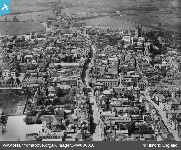
EPW006016 ENGLAND (1921). The city centre, Gloucester, 1921. This image has been produced from a copy-negative.
© Copyright OpenStreetMap contributors and licensed by the OpenStreetMap Foundation. 2026. Cartography is licensed as CC BY-SA.
Nearby Images (10)
EPW006016

EAW000728

EPW041488

EPW037845

EPW024169

EAW018731

EPW037844

EPW037846

EAW018729

EAW000727

Details
| Title | [EPW006016] The city centre, Gloucester, 1921. This image has been produced from a copy-negative. |
| Reference | EPW006016 |
| Date | 1-May-1921 |
| Link | |
| Place name | GLOUCESTER |
| Parish | |
| District | |
| Country | ENGLAND |
| Easting / Northing | 383264, 218466 |
| Longitude / Latitude | -2.2430735166976, 51.864082386729 |
| National Grid Reference | SO833185 |


