
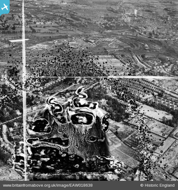
EAW018638 ENGLAND (1948). The Backhouse Nurseries (site of) and the surrounding area, Holgate, 1948. This image has been produced from a damaged negative.
© Copyright OpenStreetMap contributors and licensed by the OpenStreetMap Foundation. 2026. Cartography is licensed as CC BY-SA.
Nearby Images (6)
EAW018638
 and the surrounding area, Holgate, 1948. This image has been produced from a damaged negative.")
EAW018641

EAW018640

EAW018643

EAW018636

EAW018642

Details
| Title | [EAW018638] The Backhouse Nurseries (site of) and the surrounding area, Holgate, 1948. This image has been produced from a damaged negative. |
| Reference | EAW018638 |
| Date | 10-September-1948 |
| Link | |
| Place name | HOLGATE |
| Parish | |
| District | |
| Country | ENGLAND |
| Easting / Northing | 458347, 451403 |
| Longitude / Latitude | -1.1107364454243, 53.955228707958 |
| National Grid Reference | SE583514 |
Pins
Be the first to add a comment to this image!