
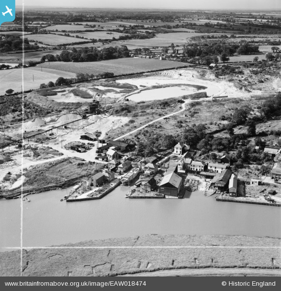
EAW018474 ENGLAND (1948). The Rowhedge Ironworks Co Shipbuilding Yard, Rowhedge, from the north-east, 1948. This image was marked by Aerofilms Ltd for photo editing.
© Copyright OpenStreetMap contributors and licensed by the OpenStreetMap Foundation. 2026. Cartography is licensed as CC BY-SA.
Nearby Images (7)
EAW018474

EAW018472

EAW018473

EAW018470

EAW018469

EAW018471

EAW018468

Details
| Title | [EAW018474] The Rowhedge Ironworks Co Shipbuilding Yard, Rowhedge, from the north-east, 1948. This image was marked by Aerofilms Ltd for photo editing. |
| Reference | EAW018474 |
| Date | 1-September-1948 |
| Link | |
| Place name | ROWHEDGE |
| Parish | EAST DONYLAND |
| District | |
| Country | ENGLAND |
| Easting / Northing | 603295, 221471 |
| Longitude / Latitude | 0.95232135377642, 51.854300816746 |
| National Grid Reference | TM033215 |
Pins

Martin |
Wednesday 15th of January 2014 10:08:59 PM |