
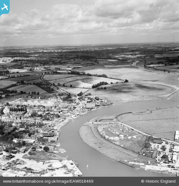
EAW018469 ENGLAND (1948). The Rowhedge Ironworks Co Shipbuilding Yard, the village and the surrounding countryside, Rowhedge, from the south-east, 1948
© Copyright OpenStreetMap contributors and licensed by the OpenStreetMap Foundation. 2026. Cartography is licensed as CC BY-SA.
Nearby Images (9)
EAW018469

EAW018474

EAW018471

EAW018472

EAW018473

EAW018470

EAW018468

EAW018466

EAW018467

Details
| Title | [EAW018469] The Rowhedge Ironworks Co Shipbuilding Yard, the village and the surrounding countryside, Rowhedge, from the south-east, 1948 |
| Reference | EAW018469 |
| Date | 1-September-1948 |
| Link | |
| Place name | ROWHEDGE |
| Parish | WIVENHOE |
| District | |
| Country | ENGLAND |
| Easting / Northing | 603312, 221538 |
| Longitude / Latitude | 0.95260729172359, 51.854896285623 |
| National Grid Reference | TM033215 |
Pins

Matt Aldred edob.mattaldred.com |
Tuesday 3rd of September 2019 08:53:59 AM | |
|
Matt Aldred edob.mattaldred.com |
Tuesday 3rd of September 2019 08:53:10 AM | |

Webrarian |
Thursday 26th of May 2016 10:23:35 AM | |
|
Webrarian |
Thursday 26th of May 2016 10:21:39 AM | |
|
Webrarian |
Thursday 26th of May 2016 10:21:07 AM | |
|
Webrarian |
Thursday 26th of May 2016 10:20:23 AM | |

Mary |
Friday 20th of December 2013 10:18:01 PM |