
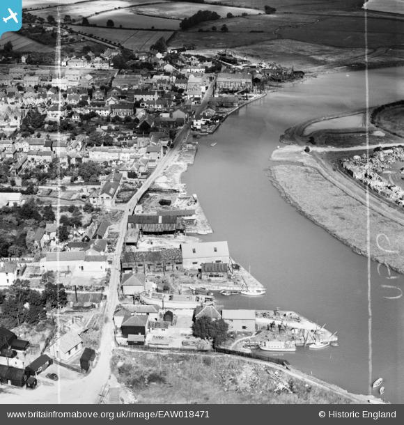
EAW018471 ENGLAND (1948). The Rowhedge Ironworks Co Shipbuilding Yard, Rowhedge, 1948. This image was marked by Aerofilms Ltd for photo editing.
© Copyright OpenStreetMap contributors and licensed by the OpenStreetMap Foundation. 2026. Cartography is licensed as CC BY-SA.
Nearby Images (8)
EAW018471

EAW018469

EAW018474

EAW018472

EAW018473

EAW018470

EAW018468

EAW018466

Details
| Title | [EAW018471] The Rowhedge Ironworks Co Shipbuilding Yard, Rowhedge, 1948. This image was marked by Aerofilms Ltd for photo editing. |
| Reference | EAW018471 |
| Date | 1-September-1948 |
| Link | |
| Place name | ROWHEDGE |
| Parish | EAST DONYLAND |
| District | |
| Country | ENGLAND |
| Easting / Northing | 603240, 221531 |
| Longitude / Latitude | 0.95155905027797, 51.854859647858 |
| National Grid Reference | TM032215 |
Pins

Matt Aldred edob.mattaldred.com |
Tuesday 9th of March 2021 05:34:43 PM | |

keithb |
Saturday 4th of April 2015 11:30:55 AM | |
|
keithb |
Saturday 4th of April 2015 11:17:39 AM | |

Martin |
Wednesday 15th of January 2014 10:20:22 PM | |
|
cptpies |
Thursday 9th of January 2014 03:39:55 PM |


User Comment Contributions

WWII Type 24 Pillbox, Rowhedge. |
cptpies |
Thursday 9th of January 2014 03:40:17 PM |