
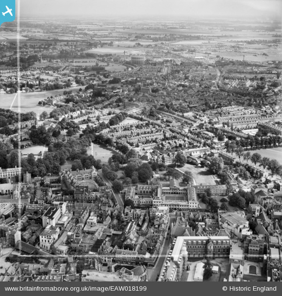
EAW018199 ENGLAND (1948). Emmanuel College and environs, Cambridge, from the south-west, 1948. This image was marked by Aerofilms Ltd for photo editing.
© Copyright OpenStreetMap contributors and licensed by the OpenStreetMap Foundation. 2026. Cartography is licensed as CC BY-SA.
Nearby Images (16)
EAW018199

EAW018198

EAW018201

EAW018196

EAW018195

EAW018197

EAW018200

EAW018202

EPW009774

EPW025461

EPW009780

EPW000039

EPW000043

EPW025464

EPW009773

EPW025475

Details
| Title | [EAW018199] Emmanuel College and environs, Cambridge, from the south-west, 1948. This image was marked by Aerofilms Ltd for photo editing. |
| Reference | EAW018199 |
| Date | 18-August-1948 |
| Link | |
| Place name | CAMBRIDGE |
| Parish | |
| District | |
| Country | ENGLAND |
| Easting / Northing | 545241, 258338 |
| Longitude / Latitude | 0.12564253461772, 52.203703557535 |
| National Grid Reference | TL452583 |
Pins

Peter Smith |
Friday 15th of March 2024 11:23:50 AM | |
|
Peter Smith |
Friday 15th of March 2024 11:21:21 AM | |
|
Peter Smith |
Friday 15th of March 2024 11:20:56 AM | |
|
Peter Smith |
Friday 15th of March 2024 11:20:31 AM | |
|
Peter Smith |
Friday 15th of March 2024 11:20:19 AM | |
|
Peter Smith |
Friday 15th of March 2024 11:20:06 AM |