
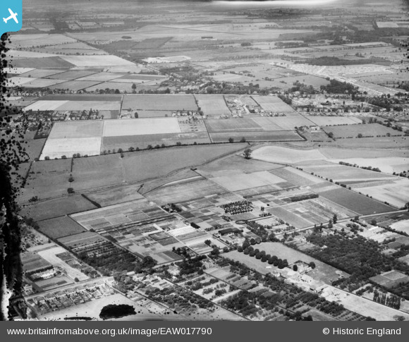
EAW017790 ENGLAND (1948). Nurseries at Bracebridge Low Fields and the surrounding area, Lincoln, from the south-east, 1948. This image has been produced from a damaged negative.
© Copyright OpenStreetMap contributors and licensed by the OpenStreetMap Foundation. 2026. Cartography is licensed as CC BY-SA.
Nearby Images (7)
EAW017790

EAW017795

EAW017794

EAW017789

EAW017793

EAW017784

EAW017785

Details
| Title | [EAW017790] Nurseries at Bracebridge Low Fields and the surrounding area, Lincoln, from the south-east, 1948. This image has been produced from a damaged negative. |
| Reference | EAW017790 |
| Date | 28-July-1948 |
| Link | |
| Place name | LINCOLN |
| Parish | |
| District | |
| Country | ENGLAND |
| Easting / Northing | 496456, 366621 |
| Longitude / Latitude | -0.55627779204911, 53.187637721707 |
| National Grid Reference | SK965666 |
Pins

redmist |
Thursday 10th of March 2022 06:43:30 PM | |
|
redmist |
Thursday 10th of March 2022 06:42:51 PM | |
|
Bristol MW |
Wednesday 23rd of October 2019 06:18:52 AM |