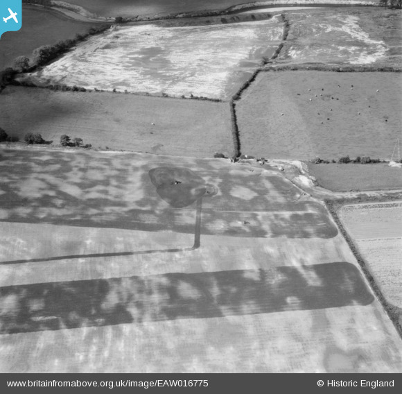
EAW016775 ENGLAND (1948). Fields to the north of Northern Moor near the River Mersey, Northenden, 1948
© Copyright OpenStreetMap contributors and licensed by the OpenStreetMap Foundation. 2026. Cartography is licensed as CC BY-SA.
Nearby Images (13)
Details
| Title | [EAW016775] Fields to the north of Northern Moor near the River Mersey, Northenden, 1948 |
| Reference | EAW016775 |
| Date | 23-June-1948 |
| Link | |
| Place name | NORTHENDEN |
| Parish | |
| District | |
| Country | ENGLAND |
| Easting / Northing | 382007, 391258 |
| Longitude / Latitude | -2.2707561038337, 53.417558642996 |
| National Grid Reference | SJ820913 |
Pins

John Ellis |
Thursday 27th of November 2014 04:30:07 PM |


![[EAW016775] Fields to the north of Northern Moor near the River Mersey, Northenden, 1948](http://britainfromabove.org.uk/sites/all/libraries/aerofilms-images/public/100x100/EAW/016/EAW016775.jpg)
![[EAW016772] Fields between Northern Moor and the River Mersey, Northenden, 1948](http://britainfromabove.org.uk/sites/all/libraries/aerofilms-images/public/100x100/EAW/016/EAW016772.jpg)
![[EAW016770] Fields between Northern Moor and the River Mersey, Northenden, 1948](http://britainfromabove.org.uk/sites/all/libraries/aerofilms-images/public/100x100/EAW/016/EAW016770.jpg)
![[EAW016491] The site for the University of Manchester Sports Ground and Barlow Moor, Northenden, 1948. This image has been produced from a print marked by Aerofilms Ltd for photo editing.](http://britainfromabove.org.uk/sites/all/libraries/aerofilms-images/public/100x100/EAW/016/EAW016491.jpg)
![[EAW016767] Fields between Northern Moor and the River Mersey, Northenden, 1948](http://britainfromabove.org.uk/sites/all/libraries/aerofilms-images/public/100x100/EAW/016/EAW016767.jpg)
![[EAW016490] The site for the University of Manchester Sports Ground, Northenden, 1948. This image has been produced from a print marked by Aerofilms Ltd for photo editing.](http://britainfromabove.org.uk/sites/all/libraries/aerofilms-images/public/100x100/EAW/016/EAW016490.jpg)
![[EAW016493] The site for the University of Manchester Sports Ground, Northenden, 1948. This image has been produced from a print marked by Aerofilms Ltd for photo editing.](http://britainfromabove.org.uk/sites/all/libraries/aerofilms-images/public/100x100/EAW/016/EAW016493.jpg)
![[EAW016492] The site for the University of Manchester Sports Ground, Northenden, 1948. This image has been produced from a print marked by Aerofilms Ltd for photo editing.](http://britainfromabove.org.uk/sites/all/libraries/aerofilms-images/public/100x100/EAW/016/EAW016492.jpg)
![[EAW016766] Fields between Northern Moor and the River Mersey, Northenden, 1948](http://britainfromabove.org.uk/sites/all/libraries/aerofilms-images/public/100x100/EAW/016/EAW016766.jpg)
![[EAW016771] Fields between Northern Moor and the River Mersey, Northenden, 1948](http://britainfromabove.org.uk/sites/all/libraries/aerofilms-images/public/100x100/EAW/016/EAW016771.jpg)
![[EAW016773] Fields between Northern Moor and the River Mersey, Northenden, 1948](http://britainfromabove.org.uk/sites/all/libraries/aerofilms-images/public/100x100/EAW/016/EAW016773.jpg)
![[EAW016769] Fields between Northern Moor and the River Mersey, Northenden, 1948](http://britainfromabove.org.uk/sites/all/libraries/aerofilms-images/public/100x100/EAW/016/EAW016769.jpg)
![[EAW016495] The site for the University of Manchester Sports Ground, Northenden, 1948. This image has been produced from a print.](http://britainfromabove.org.uk/sites/all/libraries/aerofilms-images/public/100x100/EAW/016/EAW016495.jpg)