
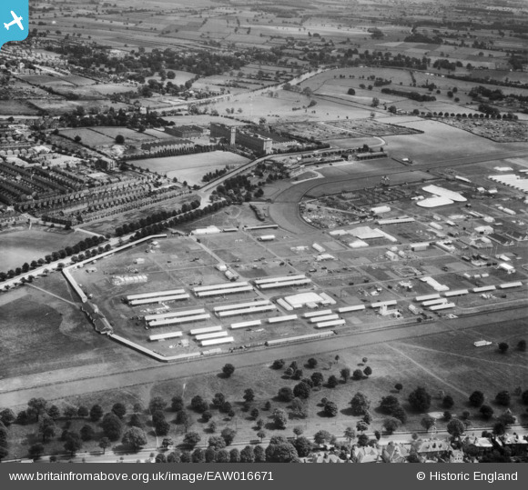
EAW016671 ENGLAND (1948). The Royal Agricultural Showground at York Racecourse (The Knavesmire), York, 1948
© Copyright OpenStreetMap contributors and licensed by the OpenStreetMap Foundation. 2026. Cartography is licensed as CC BY-SA.
Nearby Images (8)
EAW016671
, York, 1948")
EAW009401
, York, 1947. This image has been produced from a print.")
EAW009402
, York, 1947. This image has been produced from a print.")
EAW016670
, York, 1948")
EAW009398

EAW016669
, York, from the north, 1948")
EAW009405

EAW009399
, York, 1947")
Details
| Title | [EAW016671] The Royal Agricultural Showground at York Racecourse (The Knavesmire), York, 1948 |
| Reference | EAW016671 |
| Date | 23-June-1948 |
| Link | |
| Place name | YORK |
| Parish | |
| District | |
| Country | ENGLAND |
| Easting / Northing | 459478, 450027 |
| Longitude / Latitude | -1.09376945337, 53.942732875841 |
| National Grid Reference | SE595500 |
Pins
Be the first to add a comment to this image!