
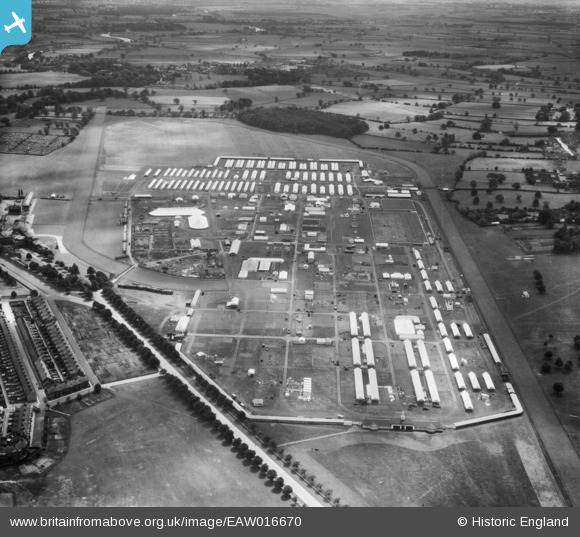
EAW016670 ENGLAND (1948). The Royal Agricultural Showground at York Racecourse (The Knavesmire), York, 1948
© Copyright OpenStreetMap contributors and licensed by the OpenStreetMap Foundation. 2026. Cartography is licensed as CC BY-SA.
Nearby Images (3)
EAW016670
, York, 1948")
EAW016672
, York, 1948")
EAW016671
, York, 1948")
Details
| Title | [EAW016670] The Royal Agricultural Showground at York Racecourse (The Knavesmire), York, 1948 |
| Reference | EAW016670 |
| Date | 23-June-1948 |
| Link | |
| Place name | YORK |
| Parish | |
| District | |
| Country | ENGLAND |
| Easting / Northing | 459328, 449853 |
| Longitude / Latitude | -1.0960884094616, 53.941186238075 |
| National Grid Reference | SE593499 |
Pins
Be the first to add a comment to this image!