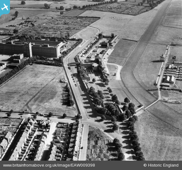
EAW009398 ENGLAND (1947). The York Racecourse County Stand and Grand Stand, York, 1947
© Copyright OpenStreetMap contributors and licensed by the OpenStreetMap Foundation. 2026. Cartography is licensed as CC BY-SA.
Nearby Images (12)
Details
| Title | [EAW009398] The York Racecourse County Stand and Grand Stand, York, 1947 |
| Reference | EAW009398 |
| Date | 17-August-1947 |
| Link | |
| Place name | YORK |
| Parish | |
| District | |
| Country | ENGLAND |
| Easting / Northing | 459657, 449882 |
| Longitude / Latitude | -1.0910708475326, 53.941409060658 |
| National Grid Reference | SE597499 |
Pins

redmist |
Friday 2nd of November 2018 04:27:56 PM |


![[EAW009398] The York Racecourse County Stand and Grand Stand, York, 1947](http://britainfromabove.org.uk/sites/all/libraries/aerofilms-images/public/100x100/EAW/009/EAW009398.jpg)
![[EAW009401] York Racecourse and the Terry's Chocolate Factory (Bishopthorpe Works), York, 1947. This image has been produced from a print.](http://britainfromabove.org.uk/sites/all/libraries/aerofilms-images/public/100x100/EAW/009/EAW009401.jpg)
![[EAW009402] York Racecourse and the Terry's Chocolate Factory (Bishopthorpe Works), York, 1947. This image has been produced from a print.](http://britainfromabove.org.uk/sites/all/libraries/aerofilms-images/public/100x100/EAW/009/EAW009402.jpg)
![[EAW009405] The York Racecourse Count Stand and Grand Stand, York, 1947. This image has been produced from a print.](http://britainfromabove.org.uk/sites/all/libraries/aerofilms-images/public/100x100/EAW/009/EAW009405.jpg)
![[EAW009399] The York Racecourse County Stand and Grand Stand and Terry's Chocolate Factory (Bishopthorpe Works), York, 1947](http://britainfromabove.org.uk/sites/all/libraries/aerofilms-images/public/100x100/EAW/009/EAW009399.jpg)
![[EAW009406] York Racecourse, York, 1947. This image has been produced from a print.](http://britainfromabove.org.uk/sites/all/libraries/aerofilms-images/public/100x100/EAW/009/EAW009406.jpg)
![[EAW009403] York Racecourse and the Terry's Chocolate Factory (Bishopthorpe Works), York, 1947. This image has been produced from a print.](http://britainfromabove.org.uk/sites/all/libraries/aerofilms-images/public/100x100/EAW/009/EAW009403.jpg)
![[EPW039026] Terry's Chocolate Factory, York, 1932](http://britainfromabove.org.uk/sites/all/libraries/aerofilms-images/public/100x100/EPW/039/EPW039026.jpg)
![[EPW016068] Terry's Chocolate Factory (Bishopthorpe Works), York, 1926](http://britainfromabove.org.uk/sites/all/libraries/aerofilms-images/public/100x100/EPW/016/EPW016068.jpg)
![[EAW016671] The Royal Agricultural Showground at York Racecourse (The Knavesmire), York, 1948](http://britainfromabove.org.uk/sites/all/libraries/aerofilms-images/public/100x100/EAW/016/EAW016671.jpg)
![[EPW017226] Terry's Chocolate Factory, York, 1926](http://britainfromabove.org.uk/sites/all/libraries/aerofilms-images/public/100x100/EPW/017/EPW017226.jpg)
![[EPW039034] Terry's Chocolate Factory and stands at York Racecourse, York, 1932](http://britainfromabove.org.uk/sites/all/libraries/aerofilms-images/public/100x100/EPW/039/EPW039034.jpg)