
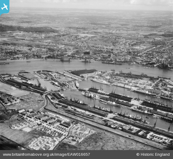
EAW016657 ENGLAND (1948). The Royal Albert Dock, King George V Dock, River Thames and environs, North Woolwich, from the north-west, 1948
© Copyright OpenStreetMap contributors and licensed by the OpenStreetMap Foundation. 2026. Cartography is licensed as CC BY-SA.
Nearby Images (14)
EAW016657

EPW008887

EAW008725

EPW010727

EPW032935

EPW032936

EPW032937

EAW022357

EAW008723

EAW021703

EAW008727

EAW005290

EAW008722

EAW008724

Details
| Title | [EAW016657] The Royal Albert Dock, King George V Dock, River Thames and environs, North Woolwich, from the north-west, 1948 |
| Reference | EAW016657 |
| Date | 17-June-1948 |
| Link | |
| Place name | NORTH WOOLWICH |
| Parish | |
| District | |
| Country | ENGLAND |
| Easting / Northing | 543348, 180647 |
| Longitude / Latitude | 0.065726918083015, 51.50606613248 |
| National Grid Reference | TQ433806 |
Pins

Robin |
Tuesday 8th of March 2022 09:29:00 PM | |
|
Lanno |
Friday 15th of January 2021 07:56:55 PM | |

Matt Aldred edob.mattaldred.com |
Monday 30th of November 2020 06:08:13 PM | |
|
redmist |
Tuesday 30th of June 2020 09:18:06 AM | |
|
redmist |
Tuesday 30th of June 2020 09:15:33 AM | |
|
redmist |
Tuesday 30th of June 2020 09:13:25 AM |
User Comment Contributions
This photograph is remarkable for showing a large part of the Royal Arsenal in Woolwich, an area where photography was strictly prohibited! |
RAHistorian |
Monday 26th of May 2014 11:07:12 PM |