
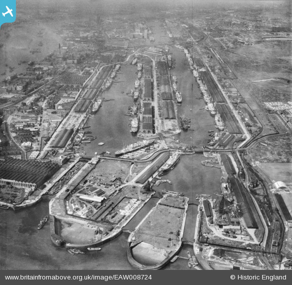
EAW008724 ENGLAND (1947). The Royal Albert Dock and the King George V Dock, North Woolwich, 1947
© Copyright OpenStreetMap contributors and licensed by the OpenStreetMap Foundation. 2026. Cartography is licensed as CC BY-SA.
Nearby Images (15)
EAW008724

EAW014133

EAW008728

EAW022358

EPW008885

EAW005290

EAW008722

EAW008723

EPW044121

EPW008887

EPW032935

EAW008740

EAW000051

EAW000055

EAW016657

Details
| Title | [EAW008724] The Royal Albert Dock and the King George V Dock, North Woolwich, 1947 |
| Reference | EAW008724 |
| Date | 8-August-1947 |
| Link | |
| Place name | NORTH WOOLWICH |
| Parish | |
| District | |
| Country | ENGLAND |
| Easting / Northing | 543580, 180411 |
| Longitude / Latitude | 0.06897173705666, 51.503886381982 |
| National Grid Reference | TQ436804 |
Pins

redmist |
Monday 29th of June 2020 08:08:51 PM | |
|
redmist |
Monday 29th of June 2020 08:08:14 PM | |
|
redmist |
Monday 29th of June 2020 08:05:32 PM | |
|
redmist |
Monday 29th of June 2020 08:04:58 PM |