
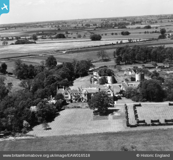
EAW016518 ENGLAND (1948). Barnwell Manor and Castle, Barnwell, 1948. This image has been produced from a print.
© Copyright OpenStreetMap contributors and licensed by the OpenStreetMap Foundation. 2026. Cartography is licensed as CC BY-SA.
Nearby Images (11)
EAW016518

EAW015476

EAW015474

EAW013677

EAW013678

EAW016521

EAW015475

EAW016520

EAW013676

EAW016517

EAW016519

Details
| Title | [EAW016518] Barnwell Manor and Castle, Barnwell, 1948. This image has been produced from a print. |
| Reference | EAW016518 |
| Date | 9-November-1948 |
| Link | |
| Place name | BARNWELL |
| Parish | BARNWELL |
| District | |
| Country | ENGLAND |
| Easting / Northing | 505039, 285154 |
| Longitude / Latitude | -0.4540690922921, 52.453855126392 |
| National Grid Reference | TL050852 |
Pins
Be the first to add a comment to this image!