
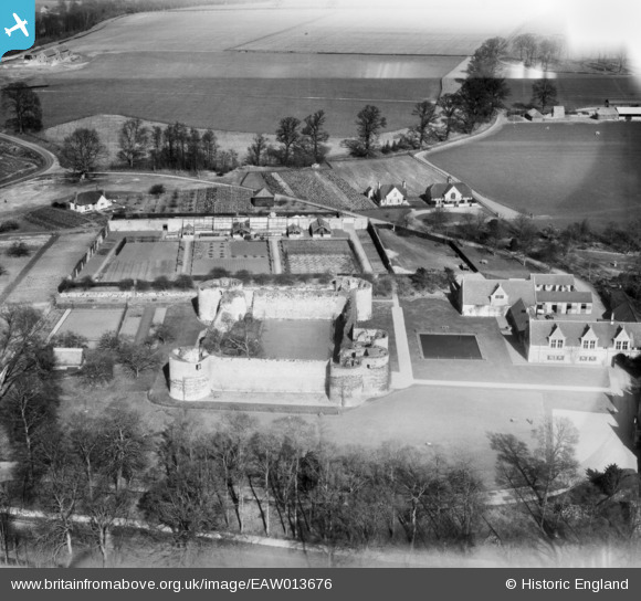
EAW013676 ENGLAND (1948). Barnwell Castle, Barnwell, 1948
© Copyright OpenStreetMap contributors and licensed by the OpenStreetMap Foundation. 2026. Cartography is licensed as CC BY-SA.
Nearby Images (11)
EAW013676

EAW015475

EAW016520

EAW013678

EAW016521

EAW016517

EAW016519

EAW015474

EAW015476

EAW013677

EAW016518

Details
| Title | [EAW013676] Barnwell Castle, Barnwell, 1948 |
| Reference | EAW013676 |
| Date | 10-March-1948 |
| Link | |
| Place name | BARNWELL |
| Parish | BARNWELL |
| District | |
| Country | ENGLAND |
| Easting / Northing | 504934, 285257 |
| Longitude / Latitude | -0.45558144583018, 52.454801050946 |
| National Grid Reference | TL049853 |
Pins
Be the first to add a comment to this image!