
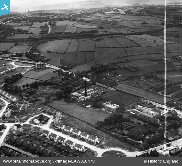
EAW016478 ENGLAND (1948). Holybrook Mills at Greengates, Bradford, from the north-east, 1948. This image has been produced from a print marked by Aerofilms Ltd for photo editing.
© Copyright OpenStreetMap contributors and licensed by the OpenStreetMap Foundation. 2026. Cartography is licensed as CC BY-SA.
Nearby Images (7)
EAW016478

EAW016474

EAW016475

EAW016476

EAW016479

EAW016477

EAW016480

Details
| Title | [EAW016478] Holybrook Mills at Greengates, Bradford, from the north-east, 1948. This image has been produced from a print marked by Aerofilms Ltd for photo editing. |
| Reference | EAW016478 |
| Date | 9-June-1948 |
| Link | |
| Place name | BRADFORD |
| Parish | |
| District | |
| Country | ENGLAND |
| Easting / Northing | 419121, 437084 |
| Longitude / Latitude | -1.7094547155889, 53.829456255887 |
| National Grid Reference | SE191371 |
