
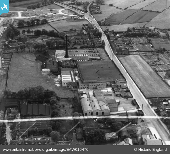
EAW016476 ENGLAND (1948). Holybrook Mills at Greengates, Bradford, 1948. This image has been produced from a print marked by Aerofilms Ltd for photo editing.
© Copyright OpenStreetMap contributors and licensed by the OpenStreetMap Foundation. 2026. Cartography is licensed as CC BY-SA.
Nearby Images (7)
EAW016476

EAW016475

EAW016478

EAW016479

EAW016474

EAW016477

EAW016480

Details
| Title | [EAW016476] Holybrook Mills at Greengates, Bradford, 1948. This image has been produced from a print marked by Aerofilms Ltd for photo editing. |
| Reference | EAW016476 |
| Date | 9-June-1948 |
| Link | |
| Place name | BRADFORD |
| Parish | |
| District | |
| Country | ENGLAND |
| Easting / Northing | 419027, 437083 |
| Longitude / Latitude | -1.7108830957081, 53.829450717469 |
| National Grid Reference | SE190371 |
Pins

redmist |
Sunday 14th of November 2021 06:16:40 PM | |
|
redmist |
Sunday 14th of November 2021 06:15:27 PM | |
|
Val |
Saturday 26th of November 2016 02:47:55 PM | |
|
Val |
Saturday 26th of November 2016 02:47:13 PM |