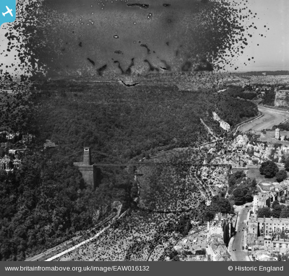
EAW016132 ENGLAND (1948). The Clifton Suspension Bridge, Clifton, from the south-east, 1948. This image has been produced from a damaged negative.
© Copyright OpenStreetMap contributors and licensed by the OpenStreetMap Foundation. 2026. Cartography is licensed as CC BY-SA.
Nearby Images (19)
EAW016132

EPW022272

EAW050559

EAW050558

EPR000063

EAW033325

EPW032539

EAW050560

EAW002263

EPW001274

EPW037150

EPW022273

EPW041480

EAW033323

EAW015138

EAW033327

EPW012024

EPW032526

EPW048299

Details
| Title | [EAW016132] The Clifton Suspension Bridge, Clifton, from the south-east, 1948. This image has been produced from a damaged negative. |
| Reference | EAW016132 |
| Date | 21-May-1948 |
| Link | |
| Place name | CLIFTON |
| Parish | |
| District | |
| Country | ENGLAND |
| Easting / Northing | 356446, 173044 |
| Longitude / Latitude | -2.6268990799982, 51.454211134564 |
| National Grid Reference | ST564730 |
Pins
Be the first to add a comment to this image!