
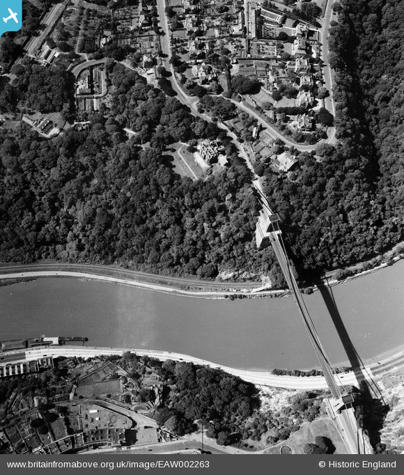
EAW002263 ENGLAND (1946). The Clifton Suspension Bridge, Long Ashton, 1946
© Copyright OpenStreetMap contributors and licensed by the OpenStreetMap Foundation. 2026. Cartography is licensed as CC BY-SA.
Nearby Images (13)
EAW002263

EAW050558

EPW032539

EPW022272

EAW016132

EPR000063

EAW050559

EPW022273

EAW033325

EAW050560

EPW001274

EPW037150

EPW041480

Details
| Title | [EAW002263] The Clifton Suspension Bridge, Long Ashton, 1946 |
| Reference | EAW002263 |
| Date | 18-August-1946 |
| Link | |
| Place name | LONG ASHTON |
| Parish | LONG ASHTON |
| District | |
| Country | ENGLAND |
| Easting / Northing | 356402, 172954 |
| Longitude / Latitude | -2.6275212616424, 51.453398463541 |
| National Grid Reference | ST564730 |
Pins

Matt Aldred edob.mattaldred.com |
Friday 3rd of June 2022 12:54:41 PM |