
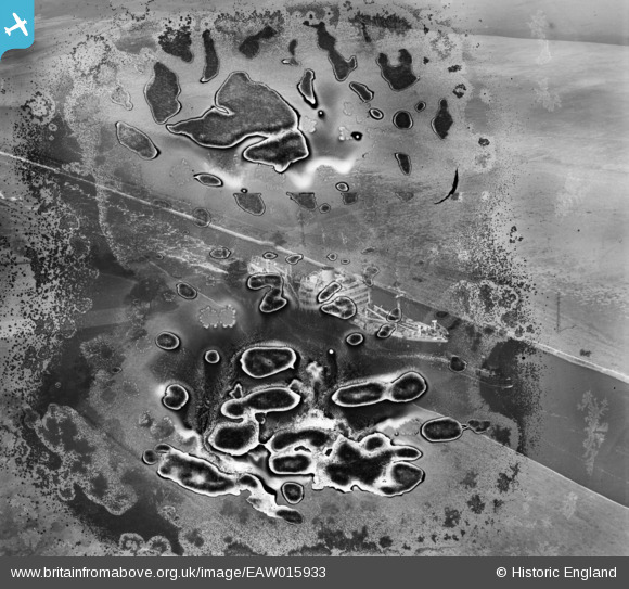
EAW015933 ENGLAND (1948). A vessel in the Manchester Ship Canal, Ince, 1948. This image has been produced from a damaged negative.
© Copyright OpenStreetMap contributors and licensed by the OpenStreetMap Foundation. 2026. Cartography is licensed as CC BY-SA.
Nearby Images (4)
EAW015933

EAW015934

EAW015932

EAW015931

Details
| Title | [EAW015933] A vessel in the Manchester Ship Canal, Ince, 1948. This image has been produced from a damaged negative. |
| Reference | EAW015933 |
| Date | 20-May-1948 |
| Link | |
| Place name | INCE |
| Parish | |
| District | |
| Country | ENGLAND |
| Easting / Northing | 345005, 377275 |
| Longitude / Latitude | -2.8250838174961, 53.289309037861 |
| National Grid Reference | SJ450773 |
Pins

TomRobin |
Saturday 28th of December 2013 05:59:43 PM |
User Comment Contributions
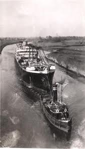
I'd say definitely the Manchester Ship Canal, from the style of the tug. Here is a photo of a similar combination of cargo vessel and tug on the canal. |
bri445 |
Wednesday 22nd of January 2014 11:35:22 PM |
It's great to be able to place this and the other two in the group! We'll update the catalogue and post the new data here in due course. Yours, Katy Britain from Above Cataloguing Team Leader |
Katy Whitaker |
Tuesday 7th of January 2014 03:14:44 PM |
I shall start the ball rolling on this one by commenting that this series of three photos were taken on the same day and show a tug towing an ocean going ship along a canal. The canal is likely to be the Manchester Ship Canal. I can not read a name of either of the vessels. The three photos in the series are EAW015932 EAW015933 and EAW015934 |

Class31 |
Saturday 21st of December 2013 08:49:08 AM |