
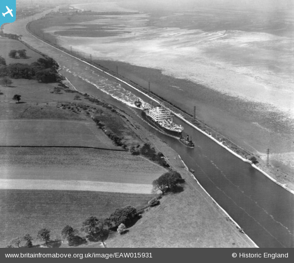
EAW015931 ENGLAND (1948). A vessel in the Manchester Ship Canal, Ince, 1948. This image has been produced from a print.
© Copyright OpenStreetMap contributors and licensed by the OpenStreetMap Foundation. 2026. Cartography is licensed as CC BY-SA.
Nearby Images (4)
EAW015931

EAW015932

EAW015933

EAW015934

Details
| Title | [EAW015931] A vessel in the Manchester Ship Canal, Ince, 1948. This image has been produced from a print. |
| Reference | EAW015931 |
| Date | 20-May-1948 |
| Link | |
| Place name | INCE |
| Parish | |
| District | |
| Country | ENGLAND |
| Easting / Northing | 344965, 377253 |
| Longitude / Latitude | -2.8256800518257, 53.289107130661 |
| National Grid Reference | SJ450773 |
Pins

Bottom Yard |
Sunday 28th of August 2022 04:28:47 PM |