
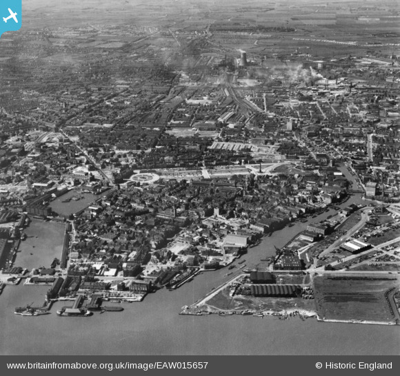
EAW015657 ENGLAND (1948). Humber Dock, the Old Harbour and city around Queen's Gardens, Kingston upon Hull, 1948. This image has been produced from a print.
© Copyright OpenStreetMap contributors and licensed by the OpenStreetMap Foundation. 2026. Cartography is licensed as CC BY-SA.
Nearby Images (12)
EAW015657

EAW046135

EPW010792

EPW036503

EPW012813

EPW036506

EPW012811

EPW036504

EPW012805

EPW010788

EPW036496

EPW036497

Details
| Title | [EAW015657] Humber Dock, the Old Harbour and city around Queen's Gardens, Kingston upon Hull, 1948. This image has been produced from a print. |
| Reference | EAW015657 |
| Date | 18-May-1948 |
| Link | |
| Place name | KINGSTON UPON HULL |
| Parish | |
| District | |
| Country | ENGLAND |
| Easting / Northing | 509886, 428901 |
| Longitude / Latitude | -0.33356751719804, 53.744666063736 |
| National Grid Reference | TA099289 |
Pins

redmist |
Friday 15th of October 2021 07:20:27 PM | |
|
redmist |
Friday 15th of October 2021 07:17:19 PM | |
|
redmist |
Friday 15th of October 2021 07:16:19 PM | |
|
redmist |
Friday 15th of October 2021 07:16:02 PM | |
|
redmist |
Friday 15th of October 2021 07:15:26 PM | |
|
redmist |
Friday 15th of October 2021 07:14:46 PM | |
|
lipsee |
Thursday 30th of August 2018 11:46:28 AM | |
|
John Wass |
Wednesday 17th of June 2015 03:10:56 PM |