
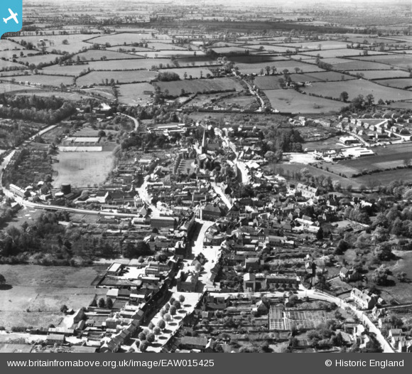
EAW015425 ENGLAND (1948). The town, Buckingham, 1948. This image has been produced from a print.
© Copyright OpenStreetMap contributors and licensed by the OpenStreetMap Foundation. 2026. Cartography is licensed as CC BY-SA.
Nearby Images (13)
EAW015425

EAW015424

EAW015426

EPW005040

EPW005042

EAW048982

EAW048981

EPW005039

EPW005043

EAW015427

EAW048983

EAW015428

EAW048980

Details
| Title | [EAW015425] The town, Buckingham, 1948. This image has been produced from a print. |
| Reference | EAW015425 |
| Date | 6-May-1948 |
| Link | |
| Place name | BUCKINGHAM |
| Parish | BUCKINGHAM |
| District | |
| Country | ENGLAND |
| Easting / Northing | 469511, 233832 |
| Longitude / Latitude | -0.98739789634337, 51.998149761134 |
| National Grid Reference | SP695338 |
Pins
Be the first to add a comment to this image!