
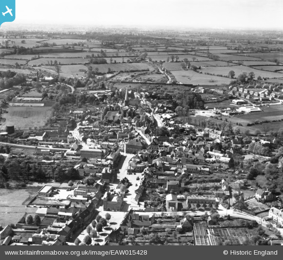
EAW015428 ENGLAND (1948). The town, Buckingham, from the north-east, 1948. This image has been produced from a print.
© Copyright OpenStreetMap contributors and licensed by the OpenStreetMap Foundation. 2026. Cartography is licensed as CC BY-SA.
Nearby Images (8)
EAW015428

EAW048983

EAW015427

EPW005043

EAW015425

EPW005039

EAW015424

EAW048981

Details
| Title | [EAW015428] The town, Buckingham, from the north-east, 1948. This image has been produced from a print. |
| Reference | EAW015428 |
| Date | 6-May-1948 |
| Link | |
| Place name | BUCKINGHAM |
| Parish | BUCKINGHAM |
| District | |
| Country | ENGLAND |
| Easting / Northing | 469617, 234046 |
| Longitude / Latitude | -0.9858105212914, 52.000060409183 |
| National Grid Reference | SP696340 |
Pins

murray |
Wednesday 8th of July 2020 04:13:04 PM | |
|
alastair wallace |
Saturday 31st of October 2015 11:11:06 PM |