
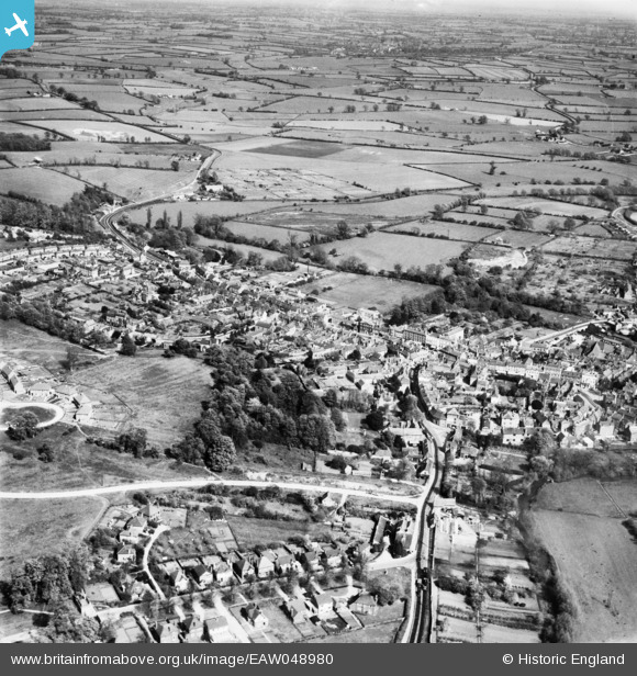
EAW048980 ENGLAND (1953). The town, Buckingham, from the west, 1953
© Copyright OpenStreetMap contributors and licensed by the OpenStreetMap Foundation. 2026. Cartography is licensed as CC BY-SA.
Nearby Images (3)
EAW048980

EAW048981

EAW015425

Details
| Title | [EAW048980] The town, Buckingham, from the west, 1953 |
| Reference | EAW048980 |
| Date | 5-May-1953 |
| Link | |
| Place name | BUCKINGHAM |
| Parish | BUCKINGHAM |
| District | |
| Country | ENGLAND |
| Easting / Northing | 469359, 234071 |
| Longitude / Latitude | -0.98956340459298, 52.00031746488 |
| National Grid Reference | SP694341 |
Pins

John W |
Sunday 21st of August 2016 08:43:23 PM | |
|
alastair wallace |
Saturday 31st of October 2015 11:01:10 PM |