
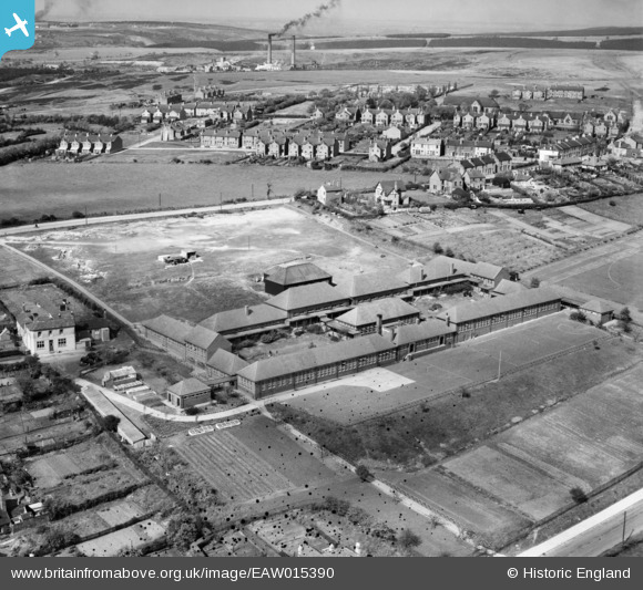
EAW015390 ENGLAND (1948). Kingsmead Secondary School and environs, Hednesford, 1948
© Copyright OpenStreetMap contributors and licensed by the OpenStreetMap Foundation. 2026. Cartography is licensed as CC BY-SA.
Nearby Images (8)
EAW015390

EAW015388
 and environs, Hednesford, 1948. This image has been produced from a damaged negative.")
EAW015391

EAW015389

EAW015386

EAW015387

EAW015392

EAW015385

Details
| Title | [EAW015390] Kingsmead Secondary School and environs, Hednesford, 1948 |
| Reference | EAW015390 |
| Date | 6-May-1948 |
| Link | |
| Place name | HEDNESFORD |
| Parish | HEDNESFORD |
| District | |
| Country | ENGLAND |
| Easting / Northing | 400430, 311658 |
| Longitude / Latitude | -1.9936357236904, 52.70225126991 |
| National Grid Reference | SK004117 |
Pins

Paul |
Friday 27th of September 2019 04:14:32 PM | |
|
Paul |
Friday 27th of September 2019 04:13:57 PM | |
|
zobbler |
Thursday 26th of June 2014 10:04:44 PM |