
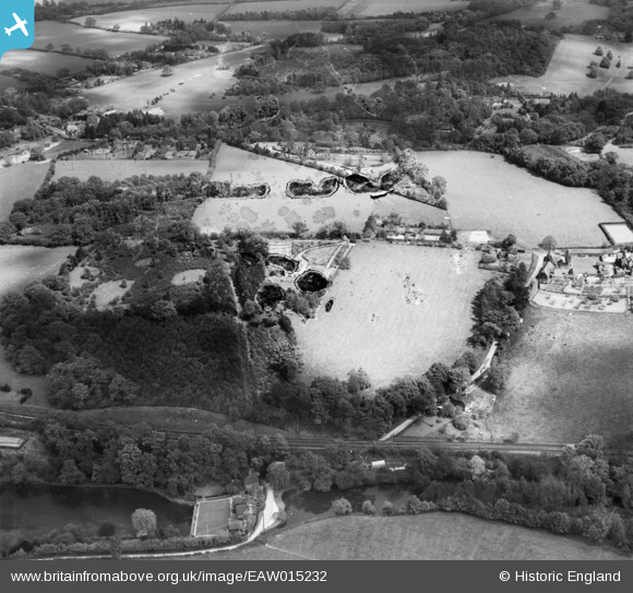
EAW015232 ENGLAND (1948). The London and Portsmouth Direct Railway Line and fields around High Enton, Great Enton, 1948. This image has been produced from a damaged negative.
© Copyright OpenStreetMap contributors and licensed by the OpenStreetMap Foundation. 2026. Cartography is licensed as CC BY-SA.
Nearby Images (4)
EAW015232

EAW015230

EAW015233

EAW015231

Details
| Title | [EAW015232] The London and Portsmouth Direct Railway Line and fields around High Enton, Great Enton, 1948. This image has been produced from a damaged negative. |
| Reference | EAW015232 |
| Date | 6-May-1948 |
| Link | |
| Place name | GREAT ENTON |
| Parish | WITLEY |
| District | |
| Country | ENGLAND |
| Easting / Northing | 495301, 140112 |
| Longitude / Latitude | -0.63723877781986, 51.151797480932 |
| National Grid Reference | SU953401 |
Pins
Be the first to add a comment to this image!