
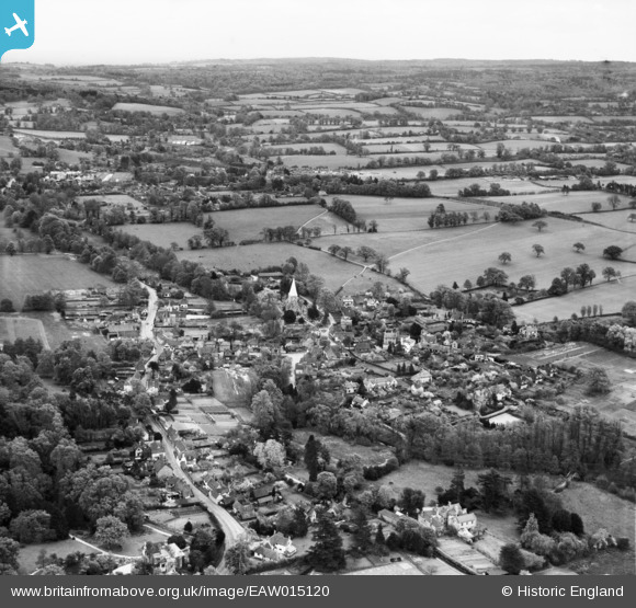
EAW015120 ENGLAND (1948). The village, Shere, from the north-west, 1948
© Copyright OpenStreetMap contributors and licensed by the OpenStreetMap Foundation. 2026. Cartography is licensed as CC BY-SA.
Nearby Images (6)
EAW015120

EAW015119

EAW015115

EAW015117

EAW015116

EAW015118

Details
| Title | [EAW015120] The village, Shere, from the north-west, 1948 |
| Reference | EAW015120 |
| Date | 30-April-1948 |
| Link | |
| Place name | SHERE |
| Parish | SHERE |
| District | |
| Country | ENGLAND |
| Easting / Northing | 507249, 147891 |
| Longitude / Latitude | -0.46412681011755, 51.219614022668 |
| National Grid Reference | TQ072479 |
Pins
Be the first to add a comment to this image!