
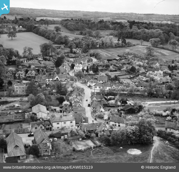
EAW015119 ENGLAND (1948). Middle Street and environs, Shere, from the north-east, 1948
© Copyright OpenStreetMap contributors and licensed by the OpenStreetMap Foundation. 2026. Cartography is licensed as CC BY-SA.
Nearby Images (6)
EAW015119

EAW015115

EAW015117

EAW015120

EAW015116

EAW015118

Details
| Title | [EAW015119] Middle Street and environs, Shere, from the north-east, 1948 |
| Reference | EAW015119 |
| Date | 30-April-1948 |
| Link | |
| Place name | SHERE |
| Parish | SHERE |
| District | |
| Country | ENGLAND |
| Easting / Northing | 507328, 147867 |
| Longitude / Latitude | -0.46300310307844, 51.219383420279 |
| National Grid Reference | TQ073479 |
Pins

Matt Aldred edob.mattaldred.com |
Friday 1st of January 2021 09:50:07 PM | |

David960 |
Wednesday 4th of February 2015 12:16:26 AM | |
|
David960 |
Wednesday 4th of February 2015 12:15:15 AM | |
|
cptpies |
Tuesday 17th of December 2013 02:22:30 PM |
User Comment Contributions

Anti Tank Blocks, Shere. |
cptpies |
Thursday 19th of December 2013 03:04:56 PM |