
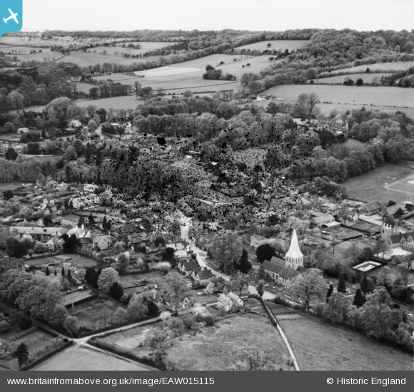
EAW015115 ENGLAND (1948). The village, Shere, from the south-east, 1948. This image has been produced from a damaged negative.
© Copyright OpenStreetMap contributors and licensed by the OpenStreetMap Foundation. 2026. Cartography is licensed as CC BY-SA.
Nearby Images (6)
EAW015115

EAW015119

EAW015117

EAW015120

EAW015116

EAW015118

Details
| Title | [EAW015115] The village, Shere, from the south-east, 1948. This image has been produced from a damaged negative. |
| Reference | EAW015115 |
| Date | 30-April-1948 |
| Link | |
| Place name | SHERE |
| Parish | SHERE |
| District | |
| Country | ENGLAND |
| Easting / Northing | 507328, 147814 |
| Longitude / Latitude | -0.46301897249907, 51.218906966168 |
| National Grid Reference | TQ073478 |
Pins
Be the first to add a comment to this image!