
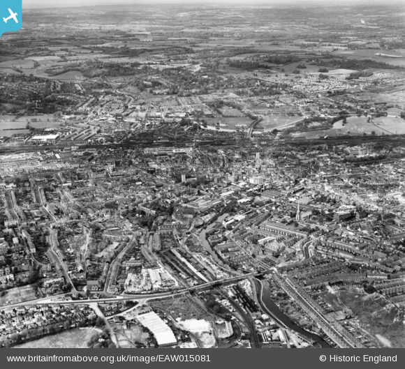
EAW015081 ENGLAND (1948). The town, Reading, from the south, 1948
© Copyright OpenStreetMap contributors and licensed by the OpenStreetMap Foundation. 2026. Cartography is licensed as CC BY-SA.
Nearby Images (7)
EAW015081

EPW000880

EPW037029

EPW037484

EPW037026

EPW000865

EPW000863

Details
| Title | [EAW015081] The town, Reading, from the south, 1948 |
| Reference | EAW015081 |
| Date | 29-April-1948 |
| Link | |
| Place name | READING |
| Parish | |
| District | |
| Country | ENGLAND |
| Easting / Northing | 471325, 172806 |
| Longitude / Latitude | -0.97347965560055, 51.44925308569 |
| National Grid Reference | SU713728 |
Pins

designking |
Monday 21st of April 2025 05:26:16 PM | |
|
designking |
Monday 21st of April 2025 05:25:51 PM | |
|
designking |
Monday 21st of April 2025 05:22:03 PM | |
|
designking |
Monday 21st of April 2025 05:20:44 PM | |
|
jontun |
Thursday 13th of February 2020 11:31:10 AM | |
|
jontun |
Thursday 13th of February 2020 11:25:01 AM | |
|
Mikkel |
Thursday 12th of October 2017 11:59:48 AM | |
|
gBr |
Sunday 27th of September 2015 06:57:08 PM | |
|
Andy from Abingdon on Thames |
Saturday 21st of June 2014 10:07:48 PM | |
|
Andy from Abingdon on Thames |
Saturday 21st of June 2014 10:03:34 PM |