
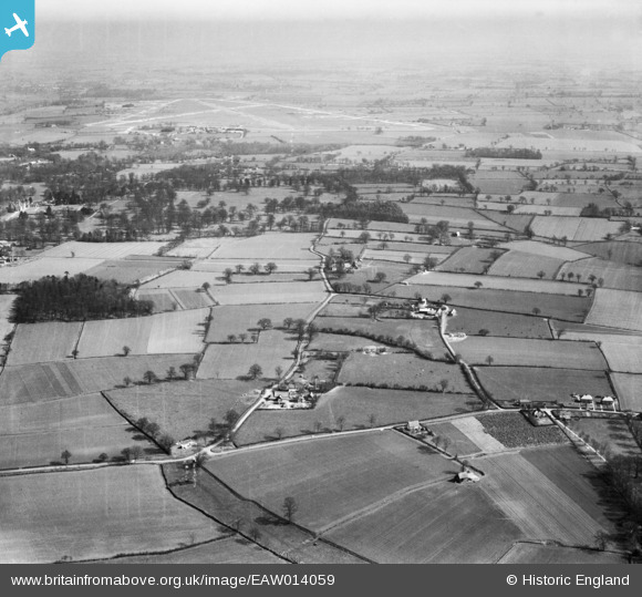
EAW014059 ENGLAND (1948). School Farm and College Farm with RAF Bungay Airfield in the distance, St Cross South Elmham, from the south-west, 1948
© Copyright OpenStreetMap contributors and licensed by the OpenStreetMap Foundation. 2026. Cartography is licensed as CC BY-SA.
Nearby Images (7)
EAW014059

EAW014060

EAW014124

EAW014062

EAW014061

EAW014123

EAW014122

Details
| Title | [EAW014059] School Farm and College Farm with RAF Bungay Airfield in the distance, St Cross South Elmham, from the south-west, 1948 |
| Reference | EAW014059 |
| Date | 25-March-1948 |
| Link | |
| Place name | ST CROSS SOUTH ELMHAM |
| Parish | ST. CROSS, SOUTH ELMHAM |
| District | |
| Country | ENGLAND |
| Easting / Northing | 629576, 284642 |
| Longitude / Latitude | 1.3759563281119, 52.411142943735 |
| National Grid Reference | TM296846 |
Pins

Paul Bass |
Wednesday 27th of November 2024 11:02:20 AM |