
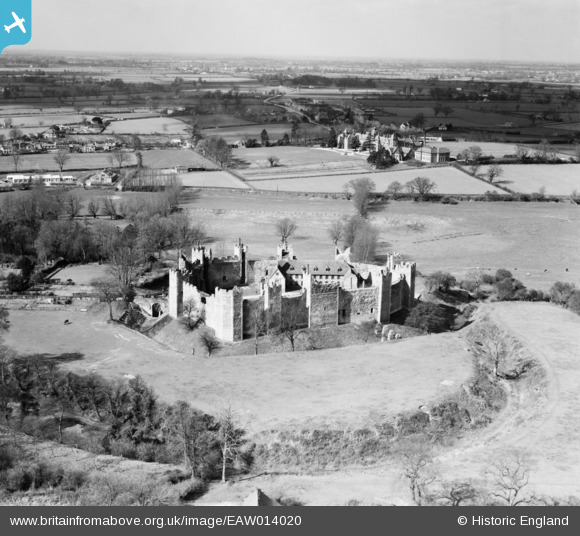
EAW014020 ENGLAND (1948). Framlingham Castle and environs, Framlingham, from the south-east, 1948
© Copyright OpenStreetMap contributors and licensed by the OpenStreetMap Foundation. 2026. Cartography is licensed as CC BY-SA.
Nearby Images (22)
EAW014020

EAW008409

EAW014018

EAW030401

EAW037245

EAW014017

EAW008407

EAW008410

EAW037246

EAW008408

EAW008406

EAW008411

EAW014015

EAW014014

EAW008413

EAW014019

EAW014016

EAW030402

EAW008412

EAW037247

EAW014013

EAW030400

Details
| Title | [EAW014020] Framlingham Castle and environs, Framlingham, from the south-east, 1948 |
| Reference | EAW014020 |
| Date | 23-March-1948 |
| Link | |
| Place name | FRAMLINGHAM |
| Parish | FRAMLINGHAM |
| District | |
| Country | ENGLAND |
| Easting / Northing | 628742, 263695 |
| Longitude / Latitude | 1.3494742067959, 52.22347579347 |
| National Grid Reference | TM287637 |
Pins

totoro |
Thursday 26th of June 2014 11:33:40 PM | |
|
totoro |
Thursday 26th of June 2014 11:32:03 PM | |
|
totoro |
Thursday 26th of June 2014 11:28:24 PM | |
|
totoro |
Thursday 26th of June 2014 11:24:52 PM | |
|
totoro |
Thursday 26th of June 2014 11:00:13 PM | |
|
totoro |
Thursday 26th of June 2014 10:50:08 PM | |
|
totoro |
Thursday 26th of June 2014 10:39:59 PM |
User Comment Contributions
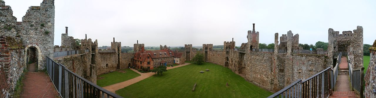
Panoramic photo of the inside of Framlingham Castle taken from the south wall Copyright Evan Fetherolf 2009 Licenced under Creative Commons Attribution licence. Source: Wikipedia - [[File:Framlingham pan 2.jpg]] |
totoro |
Thursday 26th of June 2014 11:10:54 PM |