
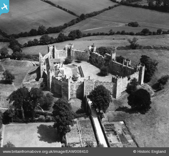
EAW008410 ENGLAND (1947). Framlingham Castle, Framlingham, 1947. This image has been produced from a print.
© Copyright OpenStreetMap contributors and licensed by the OpenStreetMap Foundation. 2026. Cartography is licensed as CC BY-SA.
Nearby Images (22)
EAW008410

EAW008407

EAW008406

EAW008411

EAW008408

EAW037246

EAW008413

EAW030401

EAW014016

EAW014014

EAW030402

EAW014017

EAW014015

EAW008412

EAW014019

EAW037245

EAW008409

EAW014018

EAW014020

EAW014013

EAW037247

EAW030400

Details
| Title | [EAW008410] Framlingham Castle, Framlingham, 1947. This image has been produced from a print. |
| Reference | EAW008410 |
| Date | 29-June-1947 |
| Link | |
| Place name | FRAMLINGHAM |
| Parish | FRAMLINGHAM |
| District | |
| Country | ENGLAND |
| Easting / Northing | 628675, 263719 |
| Longitude / Latitude | 1.3485111623529, 52.223719034377 |
| National Grid Reference | TM287637 |
Pins
Be the first to add a comment to this image!