
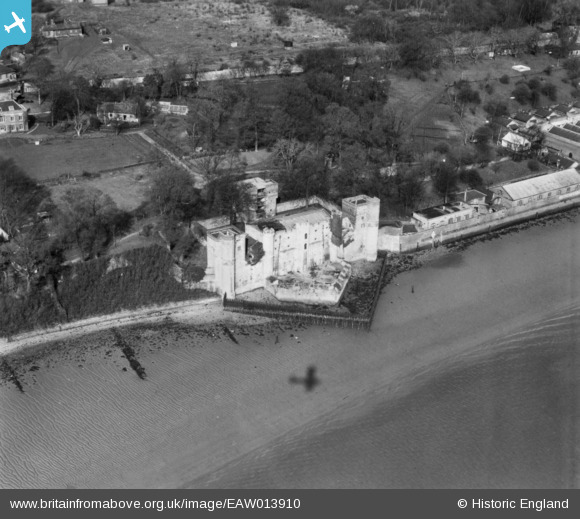
EAW013910 ENGLAND (1948). Upnor Castle, Upper Upnor, 1948. This image has been produced from a print.
© Copyright OpenStreetMap contributors and licensed by the OpenStreetMap Foundation. 2026. Cartography is licensed as CC BY-SA.
Nearby Images (4)
EAW013910

EAW013909

EAW013911
, Upper Upnor, 1948. This image has been produced from a damaged negative.")
EAW013908

Details
| Title | [EAW013910] Upnor Castle, Upper Upnor, 1948. This image has been produced from a print. |
| Reference | EAW013910 |
| Date | 18-March-1948 |
| Link | |
| Place name | UPPER UPNOR |
| Parish | FRINDSBURY EXTRA |
| District | |
| Country | ENGLAND |
| Easting / Northing | 575859, 170569 |
| Longitude / Latitude | 0.5287717583536, 51.406346001769 |
| National Grid Reference | TQ759706 |
Pins

Matt Aldred edob.mattaldred.com |
Monday 11th of March 2024 06:13:53 PM | |
|
Matt Aldred edob.mattaldred.com |
Friday 8th of March 2024 07:51:16 PM | |
|
Matt Aldred edob.mattaldred.com |
Saturday 3rd of July 2021 03:38:18 PM |