
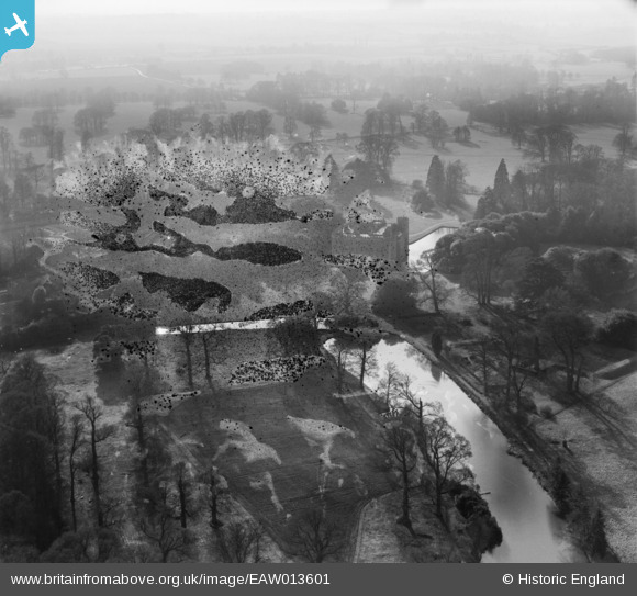
EAW013601 ENGLAND (1948). Shirburn Castle and surrounding countryside, Shirburn, from the north-east, 1948. This image has been produced from a damaged negative.
© Copyright OpenStreetMap contributors and licensed by the OpenStreetMap Foundation. 2026. Cartography is licensed as CC BY-SA.
Nearby Images (14)
EAW013601

EAW010207

EAW010213

EAW049271

EAW013602

EAW010211

EAW010208

EAW013600

EAW013604

EAW010210

EAW049272

EAW010212

EAW013603

EAW010209

Details
| Title | [EAW013601] Shirburn Castle and surrounding countryside, Shirburn, from the north-east, 1948. This image has been produced from a damaged negative. |
| Reference | EAW013601 |
| Date | 9-March-1948 |
| Link | |
| Place name | SHIRBURN |
| Parish | SHIRBURN |
| District | |
| Country | ENGLAND |
| Easting / Northing | 469828, 196013 |
| Longitude / Latitude | -0.99041208914459, 51.658094632186 |
| National Grid Reference | SU698960 |
Pins
Be the first to add a comment to this image!