
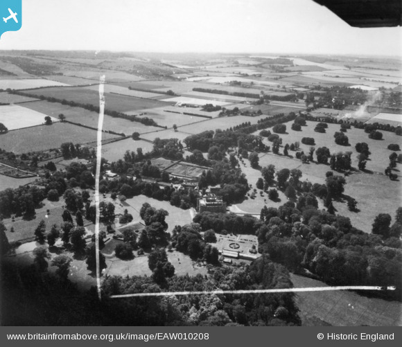
EAW010208 ENGLAND (1947). Shirburn Castle, Shirburn, from the north, 1947. This image has been produced from a print marked by Aerofilms Ltd for photo editing.
© Copyright OpenStreetMap contributors and licensed by the OpenStreetMap Foundation. 2026. Cartography is licensed as CC BY-SA.
Nearby Images (14)
EAW010208

EAW013600

EAW049272

EAW010210

EAW010212

EAW013604

EAW010211

EAW013602

EAW049271

EAW013603

EAW010213

EAW010207

EAW010209

EAW013601

Details
| Title | [EAW010208] Shirburn Castle, Shirburn, from the north, 1947. This image has been produced from a print marked by Aerofilms Ltd for photo editing. |
| Reference | EAW010208 |
| Date | 29-August-1947 |
| Link | |
| Place name | SHIRBURN |
| Parish | SHIRBURN |
| District | |
| Country | ENGLAND |
| Easting / Northing | 469679, 196052 |
| Longitude / Latitude | -0.99255822750592, 51.658463772562 |
| National Grid Reference | SU697961 |
Pins

Nowy Paul |
Saturday 19th of September 2015 04:16:05 PM | |
|
Nowy Paul |
Saturday 19th of September 2015 04:14:15 PM |