
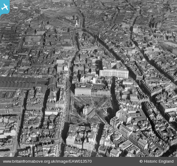
EAW013570 ENGLAND (1948). The city centre including St Philip's Cathedral and Colmore Row, Birmingham, 1948
© Copyright OpenStreetMap contributors and licensed by the OpenStreetMap Foundation. 2026. Cartography is licensed as CC BY-SA.
Nearby Images (41)
EAW013570

EAW036921

EAW036920

EAW036923

EAW036919

EAW036922

EAW036926

EAW029380

EAW029414

EAW036918

EAW036925

EPW005842

EAW026255

EAW029415

EAW013572

EAW013571

EAW029378

EAW029417
, Snows Hill Station and environs, Birmingham, from the east, 1950")
EPW037055

EAW036924

EAW029382

EAW029419

EAW029374

EAW029379

EPW053091

EAW029375

EAW029377

EAW029381

EAW029376

EAW029383

EAW013567

EAW013573

EPW005849

EAW001239

EPW038606

EAW001236

EAW029418

EAW013569

EPW057480

EPW041473

EPW005856

Details
| Title | [EAW013570] The city centre including St Philip's Cathedral and Colmore Row, Birmingham, 1948 |
| Reference | EAW013570 |
| Date | 9-March-1948 |
| Link | |
| Place name | BIRMINGHAM |
| Parish | |
| District | |
| Country | ENGLAND |
| Easting / Northing | 407077, 287126 |
| Longitude / Latitude | -1.8957805604667, 52.481642322486 |
| National Grid Reference | SP071871 |
Pins

Alan Baker |
Thursday 25th of July 2024 02:13:19 PM | |
|
Alan Baker |
Thursday 25th of July 2024 02:12:19 PM | |
|
John W |
Monday 1st of February 2021 09:17:11 PM | |

Class31 |
Tuesday 18th of November 2014 02:30:06 PM | |
|
Class31 |
Tuesday 18th of November 2014 02:29:18 PM | |
|
Class31 |
Tuesday 18th of November 2014 02:28:45 PM |


User Comment Contributions

Birmingham Cathedral, 14/08/2015 |
Class31 |
Monday 17th of August 2015 12:59:16 PM |