
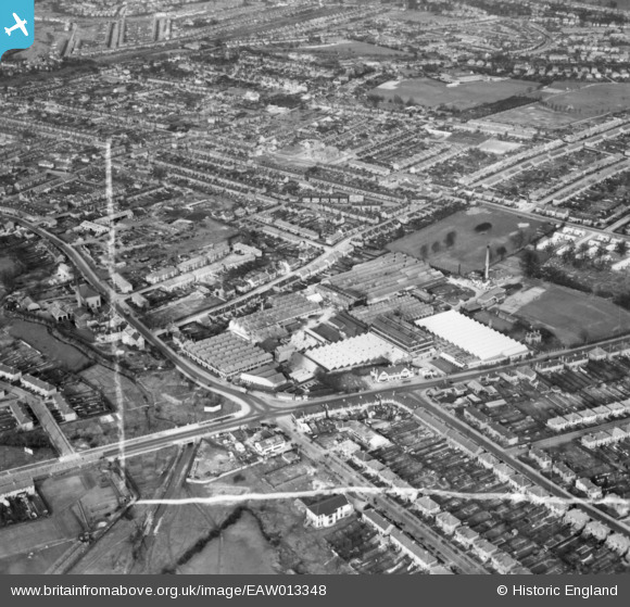
EAW013348 ENGLAND (1948). The Roneo Works and environs, Romford, 1948. This image has been produced from a print.
© Copyright OpenStreetMap contributors and licensed by the OpenStreetMap Foundation. 2026. Cartography is licensed as CC BY-SA.
Nearby Images (19)
EAW013348

EAW013354

EAW013350

EAW013357

EAW013351

EAW013353

EAW013358

EAW013355

EAW013356

EPW001395

EAW013352

EAW040960

EAW040954

EAW040957

EAW040958

EAW040956

EAW040959

EAW040953

EAW040955

Details
| Title | [EAW013348] The Roneo Works and environs, Romford, 1948. This image has been produced from a print. |
| Reference | EAW013348 |
| Date | 16-February-1948 |
| Link | |
| Place name | ROMFORD |
| Parish | |
| District | |
| Country | ENGLAND |
| Easting / Northing | 551838, 187640 |
| Longitude / Latitude | 0.19099570453452, 51.566686827029 |
| National Grid Reference | TQ518876 |
Pins

Matt Aldred edob.mattaldred.com |
Monday 20th of July 2026 04:25:35 PM | |

J May |
Monday 18th of November 2024 12:19:46 PM | |

Sparky |
Thursday 27th of July 2017 10:36:46 AM | |
|
Sparky |
Thursday 27th of July 2017 10:36:04 AM |