
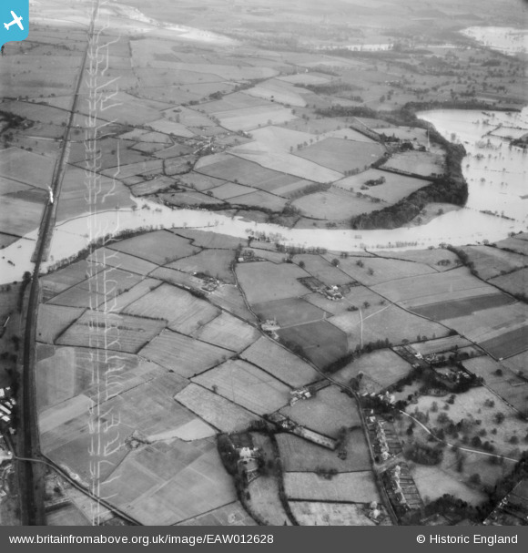
EAW012628 ENGLAND (1948). The River Severn in flood, Shrewsbury, 1948. This image has been produced from a damaged negative.
© Copyright OpenStreetMap contributors and licensed by the OpenStreetMap Foundation. 2026. Cartography is licensed as CC BY-SA.
Nearby Images (5)
EAW012628

EAW012531

EAW017233

EAW012533

EAW012532

Details
| Title | [EAW012628] The River Severn in flood, Shrewsbury, 1948. This image has been produced from a damaged negative. |
| Reference | EAW012628 |
| Date | 14-January-1948 |
| Link | |
| Place name | SHREWSBURY |
| Parish | SHREWSBURY |
| District | |
| Country | ENGLAND |
| Easting / Northing | 351845, 311988 |
| Longitude / Latitude | -2.7127432477618, 52.703076126538 |
| National Grid Reference | SJ518120 |
Pins

Jonnie |
Tuesday 5th of May 2015 08:43:41 AM | |
|
Jonnie |
Tuesday 5th of May 2015 08:42:29 AM | |
|
Jonnie |
Tuesday 5th of May 2015 08:41:16 AM |