
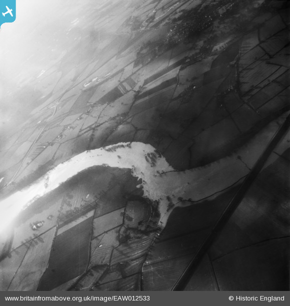
EAW012533 ENGLAND (1948). The River Severn in flood, Shrewsbury, 1948
© Copyright OpenStreetMap contributors and licensed by the OpenStreetMap Foundation. 2026. Cartography is licensed as CC BY-SA.
Nearby Images (4)
EAW012533

EAW012532

EAW012628

EAW012531

Details
| Title | [EAW012533] The River Severn in flood, Shrewsbury, 1948 |
| Reference | EAW012533 |
| Date | 14-January-1948 |
| Link | |
| Place name | SHREWSBURY |
| Parish | SHREWSBURY |
| District | |
| Country | ENGLAND |
| Easting / Northing | 351972, 311800 |
| Longitude / Latitude | -2.7108362143547, 52.701397294946 |
| National Grid Reference | SJ520118 |
Pins
Be the first to add a comment to this image!