
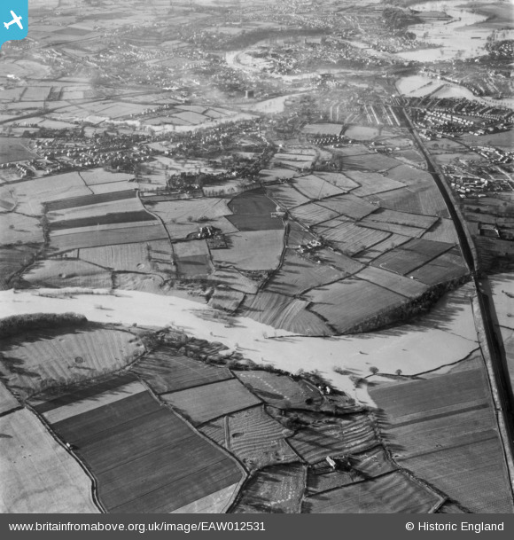
EAW012531 ENGLAND (1948). The River Severn in flood, Shrewsbury, 1948
© Copyright OpenStreetMap contributors and licensed by the OpenStreetMap Foundation. 2026. Cartography is licensed as CC BY-SA.
Nearby Images (4)
EAW012531

EAW012628

EAW017233

EAW012533

Details
| Title | [EAW012531] The River Severn in flood, Shrewsbury, 1948 |
| Reference | EAW012531 |
| Date | 14-January-1948 |
| Link | |
| Place name | SHREWSBURY |
| Parish | SHREWSBURY |
| District | |
| Country | ENGLAND |
| Easting / Northing | 351823, 312015 |
| Longitude / Latitude | -2.7130727991701, 52.703316898011 |
| National Grid Reference | SJ518120 |
Pins
Be the first to add a comment to this image!