
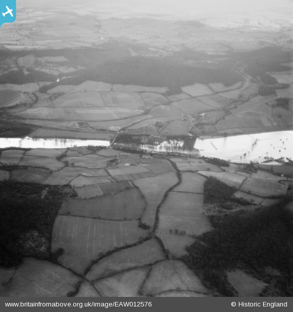
EAW012576 ENGLAND (1948). The River Severn in flood, Buildwas, 1948
© Copyright OpenStreetMap contributors and licensed by the OpenStreetMap Foundation. 2026. Cartography is licensed as CC BY-SA.
Nearby Images (6)
EAW012576

EAW009996
 and environs, Buildwas, 1947")
EAW009995
, Buildwas, 1947")
EAW009994
, Buildwas, 1947")
EAW009993
, Buildwas, 1947")
EAW012665

Details
| Title | [EAW012576] The River Severn in flood, Buildwas, 1948 |
| Reference | EAW012576 |
| Date | 14-January-1948 |
| Link | |
| Place name | BUILDWAS |
| Parish | BUILDWAS |
| District | |
| Country | ENGLAND |
| Easting / Northing | 364364, 304480 |
| Longitude / Latitude | -2.5266470896519, 52.636545709872 |
| National Grid Reference | SJ644045 |
Pins

MB |
Wednesday 20th of November 2013 12:08:49 PM | |
|
MB |
Wednesday 20th of November 2013 12:08:18 PM | |
|
MB |
Wednesday 20th of November 2013 12:07:46 PM | |
|
MB |
Wednesday 20th of November 2013 12:04:46 PM |