
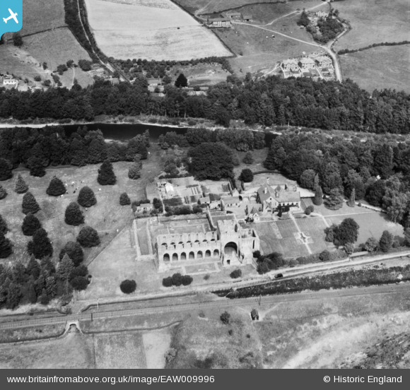
EAW009996 ENGLAND (1947). The remains of St Mary and St Chad's Abbey (Buildwas Abbey) and environs, Buildwas, 1947
© Copyright OpenStreetMap contributors and licensed by the OpenStreetMap Foundation. 2026. Cartography is licensed as CC BY-SA.
Nearby Images (6)
EAW009996
 and environs, Buildwas, 1947")
EAW009995
, Buildwas, 1947")
EAW009994
, Buildwas, 1947")
EAW009993
, Buildwas, 1947")
EAW012576

EAW012665

Details
| Title | [EAW009996] The remains of St Mary and St Chad's Abbey (Buildwas Abbey) and environs, Buildwas, 1947 |
| Reference | EAW009996 |
| Date | 31-August-1947 |
| Link | |
| Place name | BUILDWAS |
| Parish | BUILDWAS |
| District | |
| Country | ENGLAND |
| Easting / Northing | 364325, 304375 |
| Longitude / Latitude | -2.5272120768067, 52.635599156014 |
| National Grid Reference | SJ643044 |
Pins

MB |
Wednesday 20th of November 2013 12:02:59 PM |