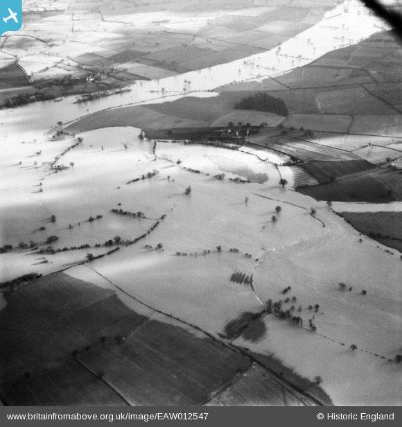
EAW012547 ENGLAND (1948). The River Severn in flood, Atcham, 1948
© Copyright OpenStreetMap contributors and licensed by the OpenStreetMap Foundation. 2025. Cartography is licensed as CC BY-SA.
Details
| Title | [EAW012547] The River Severn in flood, Atcham, 1948 |
| Reference | EAW012547 |
| Date | 14-January-1948 |
| Link | |
| Place name | ATCHAM |
| Parish | ATCHAM |
| District | |
| Country | ENGLAND |
| Easting / Northing | 355059, 308588 |
| Longitude / Latitude | -2.6647120454683, 52.672786240674 |
| National Grid Reference | SJ551086 |
Pins
Be the first to add a comment to this image!


![[EAW012547] The River Severn in flood, Atcham, 1948](http://britainfromabove.org.uk/sites/all/libraries/aerofilms-images/public/100x100/EAW/012/EAW012547.jpg)
![[EAW012548] The River Severn in flood, Atcham, 1948](http://britainfromabove.org.uk/sites/all/libraries/aerofilms-images/public/100x100/EAW/012/EAW012548.jpg)
![[EAW012639] The River Severn in flood, Atcham, 1948](http://britainfromabove.org.uk/sites/all/libraries/aerofilms-images/public/100x100/EAW/012/EAW012639.jpg)
![[EAW012549] The River Severn in flood, Atcham, 1948](http://britainfromabove.org.uk/sites/all/libraries/aerofilms-images/public/100x100/EAW/012/EAW012549.jpg)