
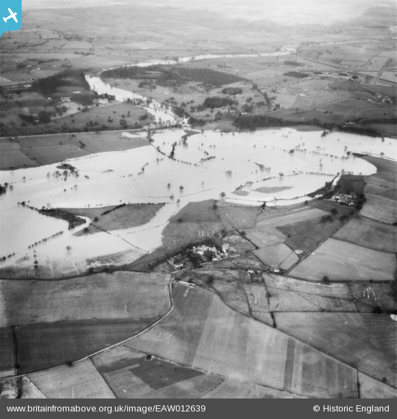
EAW012639 ENGLAND (1948). The River Severn in flood, Atcham, 1948
© Copyright OpenStreetMap contributors and licensed by the OpenStreetMap Foundation. 2025. Cartography is licensed as CC BY-SA.
Nearby Images (3)
EAW012639

EAW012546

EAW012547

Details
| Title | [EAW012639] The River Severn in flood, Atcham, 1948 |
| Reference | EAW012639 |
| Date | 14-January-1948 |
| Link | |
| Place name | ATCHAM |
| Parish | ATCHAM |
| District | |
| Country | ENGLAND |
| Easting / Northing | 354881, 308352 |
| Longitude / Latitude | -2.6673122821442, 52.670649783226 |
| National Grid Reference | SJ549084 |
Pins
 Andrew Bennett |
Saturday 12th of April 2014 12:03:20 AM | |
Andrew Bennett |
Friday 11th of April 2014 11:55:17 PM | |
Andrew Bennett |
Friday 11th of April 2014 11:54:06 PM | |
Andrew Bennett |
Friday 11th of April 2014 11:46:00 PM | |
Andrew Bennett |
Friday 11th of April 2014 11:43:11 PM | |
Andrew Bennett |
Friday 11th of April 2014 11:36:47 PM | |
Andrew Bennett |
Friday 11th of April 2014 11:36:10 PM | |
Andrew Bennett |
Friday 11th of April 2014 11:35:34 PM |