
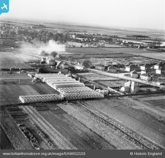
EAW012103 ENGLAND (1947). The R. Burdett Eastfield Nursery and Eastfield house, Whittlesey, from the south-east, 1947
© Copyright OpenStreetMap contributors and licensed by the OpenStreetMap Foundation. 2026. Cartography is licensed as CC BY-SA.
Nearby Images (15)
EAW012103

EAW012098

EAW012094

EAW012096

EAW012097

EAW012104

EAW012101

EAW012102

EAW012100

EAW012099

EAW012090

EAW012105

EAW012095

EAW012093

EAW012091

Details
| Title | [EAW012103] The R. Burdett Eastfield Nursery and Eastfield house, Whittlesey, from the south-east, 1947 |
| Reference | EAW012103 |
| Date | 5-November-1947 |
| Link | |
| Place name | WHITTLESEY |
| Parish | WHITTLESEY |
| District | |
| Country | ENGLAND |
| Easting / Northing | 527843, 296987 |
| Longitude / Latitude | -0.11407955699084, 52.555326591462 |
| National Grid Reference | TL278970 |
Pins

Sall |
Monday 16th of April 2018 09:36:43 PM |